.png)
Leica CityMapper-2
LiDAR
Ortho
True Ortho
Mesh
The Leica CityMapper-2 combines two nadir (RGB/NIR) and four oblique 150 MP cameras with a 2 MHz pulse rate LiDAR, providing unmatched efficiency for urban mapping applications.
Data Products
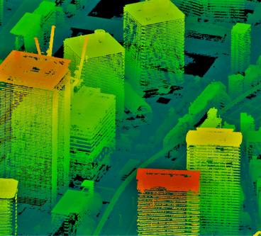
LiDAR Point Cloud
Collection of individual measurement points plotted on the X, Y, and Z axes.
Download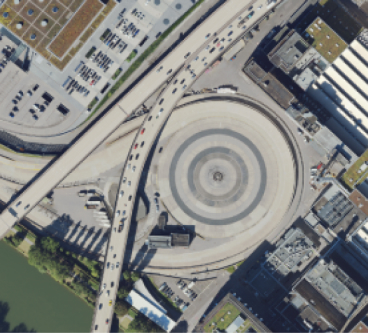
True Ortho Imagery
A orthographic projection of the ground, without tilting of the buildings.
Download